Camacha Loop Trail
Not for people with "Fear of Hights". But so wearth it.

Area

Camacha
Difficulty
Hard
Distance & Duration
15,6 KM
Accessibility
Car and Bus 129
Track & Elevation
Once you click the play button, you can download the GPS file from the menu in the upper-right corner.
Disclaimer
Important Notice!
By using this website and participating in the hikes described herein, you agree to the following terms and conditions:
- Assumption of Risk: Hiking can be a potentially dangerous activity. While we strive to provide accurate and up-to-date information about the hikes, we cannot guarantee the safety of any route. You acknowledge that you are participating in these hikes at your own risk. We are not responsible for any accidents, injuries, or fatalities that may occur while following the information provided on this website.
- Tunnels: Some hiking trails may include tunnels. It is imperative that you bring a flashlight or other adequate lighting to ensure your safety while navigating these tunnels.
- Equipment: Proper hiking shoes are essential for your safety. Always wear sturdy, reliable hiking shoes to protect your feet and provide the necessary support on uneven terrain.
- Notification: Always inform someone of your hiking plans, including the specific trail you intend to follow and your expected return time. This is a crucial safety measure in case of emergencies.
- Trail Conditions: Be aware that some parts of the trails may be impassable due to earth slides or other natural occurrences. Exercise caution and be prepared to turn back or take an alternate route if necessary.
- Liability: The information provided on this website is for general informational purposes only. We make no representations or warranties of any kind, express or implied, about the completeness, accuracy, reliability, suitability, or availability with respect to the website or the information, products, services, or related graphics contained on the website for any purpose. Any reliance you place on such information is therefore strictly at your own risk.
By proceeding with any hike described on this website, you agree to indemnify and hold harmless the website owners and contributors from any claims, liabilities, damages, or expenses (including legal fees) arising from your participation in the hikes.
Stay Safe and Enjoy Your Hike!
Good To Know
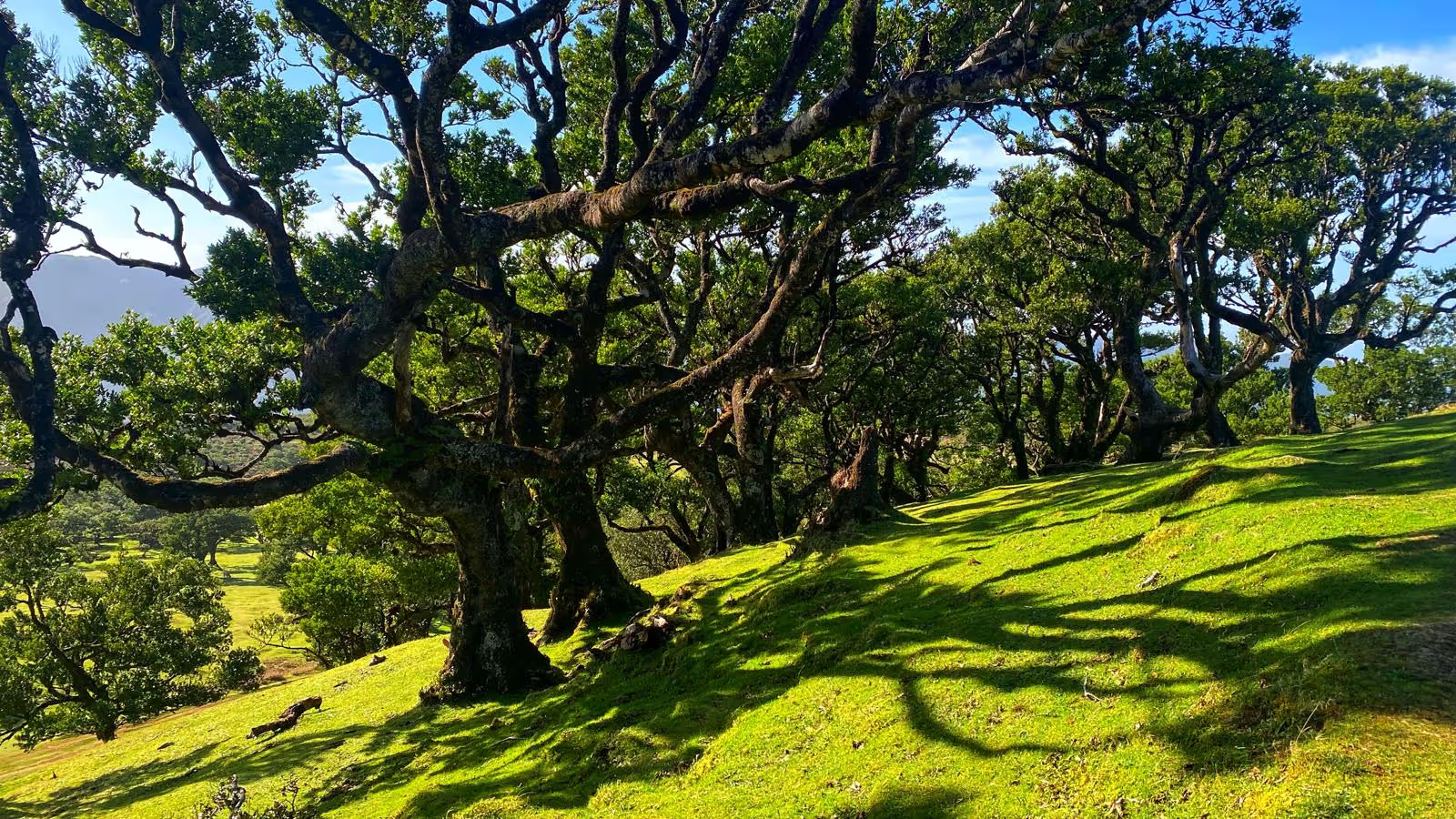
This hike starts from the city center of Camacha and takes you through forests, along dramatic cliffside paths, and follows the Levada irrigation system. Despite its length of 13.6km, we recommend it as a loop trail featuring city walks, forest walks, narrow cliff paths with panoramic views of the mountains and ocean, and varied terrain so you never retrace your steps. Along the way, you'll see a huge waterfall from a distance and a small waterfall right on the path, perfect for a refreshing shower.
The route is lined with flowers and huge butterflies with striking orange wings. Part of the trail follows two Levadas. Levada dos Tornos in the beginning and Levada da Serra do Faial, which are both mostly flat, though some sections are steep but short. This hike is not a mountain climb, but it offers a mix of city, forest, and dramatic cliffside walks with stunning views. At the end of the trail, you'll find snack bars and small restaurants with friendly locals and positive vibes.
The trail has it all: city walks, forest walks, levada paths, dramatic cliffs, and panoramic views. It's not difficult, and you can take breaks after the midway point for drinks and snacks. Be careful not to get lost; use our free trail map by downloading the file below and the Maps.me app, which works offline.
Wear comfortable shoes, a cap, sunscreen, and a light jacket for colder or windy sections. Bring a small snack and be careful in the tunnels. Use a flashlight or your phone and watch your head, as the tunnels are low and uneven. Your shoes may get wet, so walk carefully. The tunnels are short, and you'll always see the exit, so it's not too scary.
Pay attention to where you step, as some parts of the trail are narrow. Stop to take photos or videos; don't try to walk and film at the same time. Safety first! Have fun, and if you get lost, just ask the friendly locals for help. Enjoy your hike! Also during the Hike you will Pass a lovely Poncha Bar called: Portas Vermelhas.
Facilities
Location
Largo Conselheiro Aires de Ornelas 10 19, 9135-053 Camacha, Portugal
To start navigation on your phone, click 'View larger map' in the top left corner of the map.
Sometimes, finding the exact location of the hike can be challenging. That’s why we’ve included GPS coordinates to make it easier to reach.
32.679644
-16.844166
Highlights
The only pass you need in paradise
BANANA JOE SAVES THE DAY!
Episode 1: The Blocked Levada

A huge boulder has blocked the levada. Farmer Manuel's banana plants have no water!
MADEIRA NEEDS
YOUR HELP!
Are you ready to save the levada?